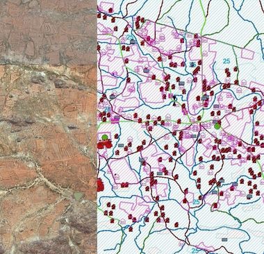
Aerial Survey

Detailed aerial images and maps available in the UK.
Do you need aerial maps for your industrial project? BKS (NI) Ltd can help.
Give us a call today for more details.
Give us a call today for more details.
We provide detailed surveys
BKS (NI) Ltd helps you efficiently undertake aerial surveys based on your requirements. BKS (NI) have access to modern aerial survey aircrafts, together with a full suite of sensors to support virtually any airborne imaging, photogrammetric or topographic mapping project.
Get in touch
The latest digital sensors and data processing technologies are used for the acquisition of high resolution vertical and infra-red imagery offering high accuracy aerial mapping products. All aircrafts are equipped with the latest in airborne GPS and navigation technology. The sensors are also equipped with an Inertial measurement unit (IMU) mounted on gyro-stabilized platforms.
Using all these sources the imagery can be easily transformed into orthophotography and Digital Elevation Models (DEM) and the digital camera bands can be exported as stereo pairs in all commonly read formats to develop planimetric, topographic, and other types of photogrammetrically derived data products.
Large format digital camera systems can achieve accuracies up to +/- 50mm RMSE on hard surfaces.
We serve clients across the UK and are based in Coleraine, Londonderry.
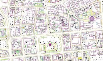
Topographical Mapping
Detailed mapping that accurately represents the features, including relief, hydrography, vegetation and cultural that appear on the Earth’s surface. Normally topographical maps include contours. Mainly used for Urban Planning and Environmental applications as well as Recreational maps
Photogrammetric Mapping
Mapping captured from new or existing high-resolution aerial photography to a set specification and accuracy. It is captured using modern stereo plotters running Summit Evolution capture software. Accuracies of up to +/- 50mm RMSE in height can be achieved.
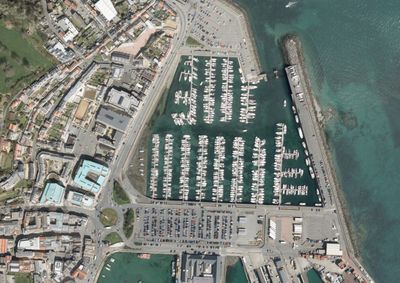
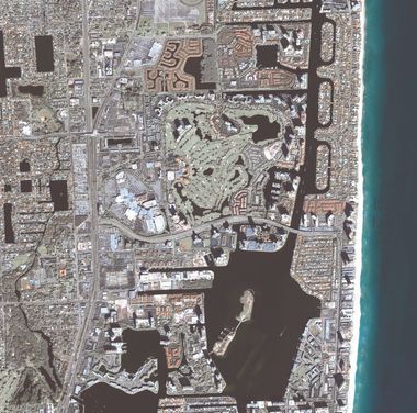
Vertical Imagery
High resolution Colour RGB aerial imagery is acquired using the latest large format cameras mounted in modern aerial survey aircrafts. Imagery can be flown at resolutions ranging from 4cm to 20cm Ground Sample Distance (GSD) depending on the requirement. It is an essential platform in the production of photogrammetric mapping.
High resolution Colour Infra-red aerial imagery can be acquired in conjunction with the Colour RGB imagery using the same up to date large format cameras mounted in modern aerial survey aircrafts. Mainly used for Forestry and Agriculture analysis as well as Environmental type applications.
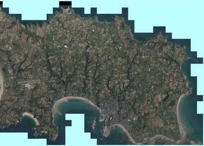
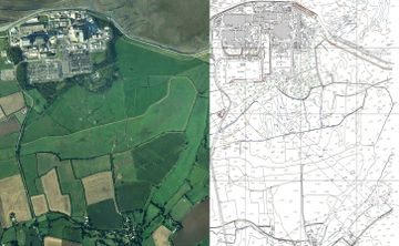
Orthophotography
Geometrically corrected (orthorectified) vertical imagery with the accuracy of a topographical map. Can be used as a base photographic layer in GIS applications. Especially useful in urban and regional planning or as a tool to revise topographic maps.
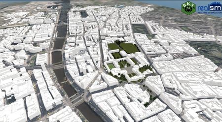
3D Building Model
3D Building Models which can be supplied as Wireframe models or Block models. BKS (NI) can provide Block models to Level of Detail LOD 1 or LOD 2 and if required can create to LOD 3 using an outside partner. Used for Urban Planning, Architecture, Visualisations and Modelling applications.
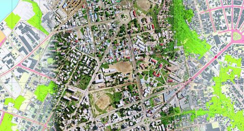
GIS Mapping
Topographical Mapping created specifically for use in Geographic Information Systems (GIS). GIS mapping data has benefits in almost every industry. Data can be provided in a format to suit most GIS platforms.
Satellite Imagery
BKS (NI) can provide a range of Satellite Imagery at varying resolutions (GSD) using authorised distribution partners.
Satellite Interpretation
2D Mapping derived from the interpretation of specific features from Satellite Imagery. Used for a range of Military & Environmental type applications.
Need aerial view and mapping information
within the United Kingdom?
within the United Kingdom?
Call us now on
028 7032 8100
Get in touch

© 2024. The content on this website is owned by us and our licensors. Do not copy any content (including images) without our consent.